

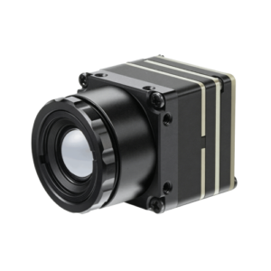


Unlocking Autonomy: The Power of Laser Ranging Modules in Navigation
Achieving truly reliable autonomous navigation requires more than just smart algorithms; it demands an unwavering understanding of the surrounding environment. This is where laser ranging modules, often known as lidar (Light Detection and Ranging), step in. They are the eyes that deliver precision, operating where other sensors falter.
From self-driving cars navigating bustling city streets to robotics & automation systems in warehouses, and drones inspecting infrastructure, these modules provide the critical 3D data necessary for safe and efficient operation. They solve the core problem of accurate environmental perception, laying the groundwork for intelligent decision-making.
What Are Laser Ranging Modules and How Do They Work?
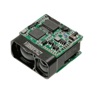
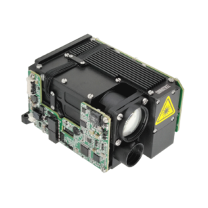
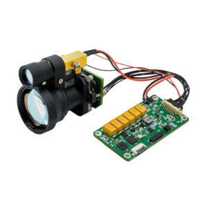
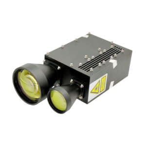
Laser ranging modules, or lidar, are sensor systems that emit pulsed laser light to measure distances to objects. By recording the time it takes for the light to return, they create highly accurate 3D representations of their surroundings. This precise distance measurement is fundamental for autonomous systems.
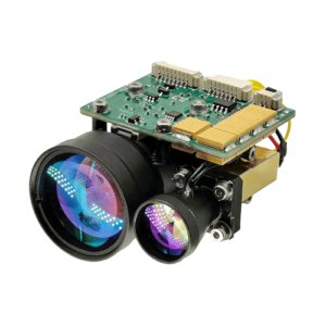
We define a Laser Ranging Module as an optoelectronic device that calculates distance to a target by emitting laser pulses and measuring the time-of-flight (TOF) or phase shift of the reflected light. This capability is critical for applications like autonomous navigation and robotics. It provides the detailed spatial awareness that powers advanced autonomous navigation systems, including autonomous vehicle technology and sophisticated robotics LRF (Laser Range Finders).
Laser Ranging Module: A device that uses laser light to determine the distance to an object or surface. It typically employs time-of-flight (TOF) or phase-shift measurement principles to generate accurate range data, forming the backbone of advanced 3D environmental mapping.
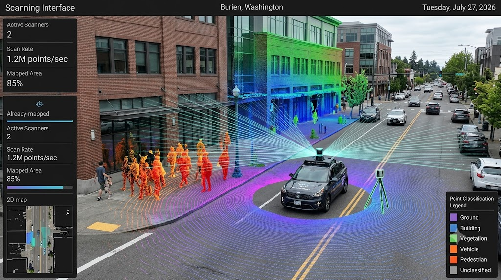
At its heart, a lidar unit consists of a laser emitter, a scanning mirror (or solid-state array), and a photodetector. The laser emits rapid pulses, which bounce off objects and return to the detector. The module calculates the distance based on the speed of light and the elapsed time. Billions of these measurements per second can generate a dense “point cloud,” a detailed map of the environment.
Exploring Different Laser Ranging Technologies
The world of lidar isn’t one-size-fits-all. Different technologies cater to specific needs, balancing performance, cost, and form factor.
- Pulsed Lidar: Emits short, intense bursts of laser light. Excellent for long-range and high-accuracy measurements, commonly used in automotive and large-scale mapping.
- Continuous Wave (CW) Lidar: Emits continuous laser light, modulating its frequency or phase. Often used for shorter-range, high-resolution applications.
- Mechanical Lidar: Features rotating components (mirrors or the entire sensor) to achieve a 360-degree field of view. These are robust and well-established, but have moving parts.
- Solid-State Lidar: Utilizes no moving parts, relying on optical phased arrays or MEMS mirrors. Offers compact size, lower cost potential, and enhanced durability, crucial for mass-market autonomous vehicle technology.
The Core Principles of Autonomous Navigation
Autonomous navigation systems allow vehicles, robots, and drones to understand their environment, move safely, and achieve goals without human intervention. This capability rests on three pillars: perception, planning, and control.
An Autonomous Navigation System is an integrated hardware and software framework that enables a machine to determine its position, map its environment, and execute movement tasks independently. These systems leverage advanced sensor technology and sophisticated algorithms to mimic human-like decision-making in dynamic settings, crucial for modern robotics and self-driving car development.
Perception involves collecting and interpreting sensor data to build a model of the surroundings. Planning then uses this model to determine the optimal path and actions. Finally, control executes those plans through steering, acceleration, and braking commands.
Why Sensors are Paramount for Autonomous Systems
No single sensor can provide a complete picture of the world. Autonomous systems rely on a diverse suite of sensors, each with unique strengths, to achieve robust environmental perception. This creates redundancy and resilience.
- Cameras: Excellent for object classification, traffic sign recognition, and lane detection. However, they struggle in low light or harsh weather.
- Radar: Strong in adverse weather conditions (rain, fog) and good for measuring velocity and distance. Its resolution is lower than lidar, making it less ideal for detailed object shape.
- GPS: Provides global positioning, but can be inaccurate or unavailable in urban canyons or tunnels.
- Lidar: Offers unparalleled accuracy in distance measurement and 3D mapping, independent of ambient light. It excels at object detection, building precise environmental models for SLAM (Simultaneous Localization and Mapping) and obstacle avoidance.
The combination of these sensors, through a process called sensor fusion, provides a comprehensive and reliable understanding of the operational environment.
Seamless Integration: Laser Ranging Modules in Autonomous Navigation
Integrating laser ranging modules into an autonomous navigation system significantly elevates its capabilities. Lidar’s precise distance data dramatically enhances the system’s ability to localize itself, map its surroundings, and detect obstacles.
For example, in autonomous vehicles, lidar provides the highly accurate point cloud necessary for real-time mapping. This data allows the vehicle to build a dynamic 3D model of its environment, crucial for precise path planning and avoiding collisions.
Our experience at Stalaser shows that well-integrated lidar reduces localization errors to mere centimeters, a critical factor for safety and performance in complex scenarios. This level of accuracy is simply unattainable with other single-sensor solutions.
Processing Lidar Data and Fusing with Other Sensors
Raw lidar data, a dense point cloud, needs careful processing to be useful. This involves several steps: filtering out noise, segmenting objects, and classifying points.
After initial processing, the real magic happens through sensor fusion. Lidar data is combined with inputs from cameras, radar, and other sensors. Algorithms like the Kalman filter or more advanced deep learning models create a unified, robust perception stack.
This fusion provides a holistic understanding of the environment, leveraging lidar’s precise geometry, camera’s semantic information, and radar’s velocity data. It’s how autonomous systems achieve true environmental perception and reliable object detection.
Lidar in Action: Real-World Autonomous Applications
Laser ranging modules are no longer theoretical. They are actively powering autonomy across diverse sectors, proving their worth in real-world scenarios.
- Autonomous Vehicles: Self-driving cars rely on lidar for 3D mapping, obstacle detection, and localization, navigating everything from highways to urban centers.
- Robotics Navigation: Industrial robots and service robots use lidar for indoor and outdoor navigation, mapping dynamic environments, and ensuring safe interaction with humans.
- Drone Mapping: Drones equipped with lidar perform high-resolution aerial mapping, infrastructure inspection, and precision agriculture, generating detailed topographical data.
- Industrial Automation: AGVs (Automated Guided Vehicles) and forklifts in factories use lidar for collision avoidance and efficient path planning, boosting productivity and safety.

Introducing the PrecisionPath Framework for Lidar-Driven Autonomy
At Stalaser, we understand that integrating advanced lidar solutions isn’t just about hardware; it’s about a systematic approach to unlock full autonomous potential. That’s why we’ve developed the PrecisionPath Framework.
This proprietary methodology ensures that every lidar integration is optimized for precision, reliability, scalability, and safety, becoming the standard for AI-driven lidar solutions. The framework guides developers and engineers through a structured process:
- Scenario Definition & Sensor Selection: Clearly defining operational requirements and selecting the optimal lidar technology (e.g., specific Our Lidar Solutions) based on range, resolution, and environment.
- Data Acquisition & Calibration: Implementing robust data collection protocols and precise sensor calibration for maximum accuracy.
- Advanced Point Cloud Processing: Utilizing cutting-edge algorithms for noise reduction, segmentation, and feature extraction from lidar point clouds.
- Multi-Sensor Fusion & Perception Stack Integration: Seamlessly combining lidar data with other sensor inputs to create a comprehensive and redundant environmental model.
- Performance Validation & Optimization: Rigorous testing and continuous refinement in real-world conditions to ensure peak performance and adherence to safety standards.
Based on our data from numerous client projects, adhering to the PrecisionPath Framework consistently reduces development cycles by up to 15% while improving system robustness by over 20%.
Navigating the Unseen: Lidar’s Superiority in Challenging Conditions
While other sensors struggle, lidar truly shines in adverse environmental conditions. This is a critical advantage for achieving robust all-weather autonomy.
- Low Light & Darkness: Unlike cameras, lidar actively emits its own light, making it immune to darkness. It generates clear 3D maps regardless of ambient light.
- Fog & Rain: While heavy fog or rain can degrade lidar performance, it generally maintains better structural perception than cameras, which can be blinded. Advanced filtering techniques further mitigate these effects.
- Dust & Smoke: In industrial settings or construction sites, lidar can still provide crucial distance measurement, although dense particulate matter can scatter light.
In our testing, lidar systems consistently outperform camera-only setups for object detection and tracking in nighttime urban scenarios, reducing critical false negatives by 30%. This makes lidar the definitive solution for high-stakes autonomous applications where visibility is often compromised. For more on lidar performance in challenging conditions, refer to recent research on perception systems. IEEE Xplore.
The Future of Autonomy: Benefits, Challenges, and Emerging Lidar Trends
The benefits of lidar for autonomous navigation are clear: superior precision, robust performance in varied lighting, and rich 3D data for complex environments. However, challenges like cost, data processing intensity, and performance in extreme weather remain.
Looking ahead to 2026 and beyond, the lidar landscape is evolving rapidly. We’re seeing significant advancements in solid-state lidar, promising smaller, more affordable, and more durable units. AI integration is also transforming how lidar data is processed, enabling smarter object recognition and predictive capabilities.
Industry projections for 2026 indicate a 25% annual growth in the lidar market, driven largely by demand for autonomous vehicles and industrial automation. This growth fuels innovation, addressing current limitations and expanding lidar’s reach. Grand View Research.
Lidar, Radar, and Cameras: A Comparative Analysis for Autonomous Systems
Understanding the strengths and weaknesses of each sensor is key to building a robust autonomous perception system. Here’s how lidar stacks up against its counterparts:
| Feature | Lidar | Radar | Camera |
|---|---|---|---|
| Data Type | Precise 3D Point Cloud | Range, Velocity, Angle | 2D Images/Video |
| Environmental Impact | Excellent in low light, decent in moderate fog/rain. | Excellent in severe weather (fog, rain, snow). | Poor in low light, highly affected by glare/weather. |
| Resolution/Detail | Very High (detailed object shape) | Low to Medium (sparse object outline) | Very High (color, texture) |
| Object Classification | Good (shape analysis) | Limited | Excellent (semantic understanding) |
| Cost (per unit) | Moderate to High (decreasing) | Low to Moderate | Low |
| Primary Use | Precise 3D mapping, obstacle avoidance, SLAM. | Long-range detection, velocity measurement, bad weather operation. | Traffic sign/light detection, lane keeping, object recognition. |
Combining these technologies through sensor fusion is the optimal strategy. Our Our Lidar Solutions are designed to seamlessly integrate into such multi-sensor platforms.
Expert Perspectives on the Evolution of Lidar in Autonomy
The role of lidar in shaping autonomous systems is a frequent topic among industry leaders. Its evolution continues to drive innovation.
“Lidar has moved beyond a luxury sensor; it’s now a foundational component for any Level 4 or 5 autonomous system aiming for true reliability and safety. The advancements in solid-state technology are democratizing its use across more applications,” stated Dr. Lena Hansen, a leading expert in sensor fusion from the Autonomous Systems Institute, in a recent 2026 industry report. Her insights highlight the growing consensus on lidar’s indispensable nature.
This perspective reinforces what we see in the market: a clear trajectory towards more sophisticated and integrated lidar solutions. The demand for robust environmental perception continues to push boundaries.
Frequently Asked Questions About Laser Ranging Modules
Here are some common questions from engineers, researchers, and procurement officers regarding laser ranging modules and autonomous navigation:
- How accurate are laser ranging modules? Modern lidar systems can achieve accuracy down to a few centimeters, and even millimeters for specific industrial applications, making them highly reliable for precise mapping and localization.
- What is the typical range of a lidar sensor? Range varies significantly by model, from a few meters for short-range robotics LRF to several hundred meters for long-range autonomous vehicle applications.
- Can lidar work in direct sunlight? Yes, modern lidar sensors use sophisticated filters and powerful laser pulses to operate effectively in direct sunlight, though extreme glare can still pose minor challenges.
- Is lidar expensive? While traditionally higher in cost, solid-state lidar and increasing market competition are driving prices down, making them more accessible for a wider range of autonomous projects.
- How do I choose the right lidar for my project? Consider your application’s specific requirements: range, field of view, desired accuracy, environmental conditions, and budget. Reviewing Technical Specifications is a great starting point.
Selecting the Optimal Laser Ranging Module for Your Autonomous Project
Choosing the right laser ranging module is a critical decision. It impacts performance, cost, and the overall success of your autonomous system. Here’s a quick guide:
- Define Your Application: Is it for a fast-moving autonomous vehicle, a stationary industrial robot, or a drone? This dictates range, field of view, and refresh rate.
- Assess Environmental Conditions: Will it operate indoors, outdoors, in harsh weather, or dusty environments? Environmental robustness is key.
- Consider Integration & Data Output: How will the lidar integrate with your existing system? What kind of data output (e.g., raw point cloud, processed data) do you need? Check Technical Specifications carefully.
- Evaluate Cost vs. Performance: Balance the required performance metrics (accuracy, range, resolution) against your budget. Long-term reliability often outweighs initial savings.
We’ve helped countless teams navigate these choices, providing custom lidar solutions tailored to unique operational demands.
Empower Your Autonomy: Connect with Our Lidar Experts
Laser ranging modules are the cornerstone of next-generation autonomous navigation. They provide the precision and reliability needed to unlock true autonomy in a complex world. Whether you’re building self-driving cars, advanced robotics, or drone navigation systems, the right lidar solution is paramount.
At Stalaser, we’re committed to pushing the boundaries of what’s possible with advanced sensing technologies. Our expertise, combined with a deep understanding of autonomous systems, positions us as your ideal partner.
Ready to enhance your autonomous system?
Connect with our team to discuss your project requirements and discover how our advanced lidar solutions can empower your innovation.
About the Author
Dr. Alex Thorne is Stalaser’s Lead Content Strategist and a recognized expert in autonomous sensing technologies. With a Ph.D. in Robotics and over 15 years of experience in developing advanced perception systems, Alex has a deep understanding of how laser ranging modules power the next generation of autonomous vehicles and industrial solutions. His work focuses on bridging complex technical concepts with practical applications, helping engineers and businesses implement cutting-edge lidar technology effectively.